Windnavigator and RRAP Are Now One
June 18, 2025
We're excited to unveil a unified platform that delivers enhanced accuracy, seamless workflows, and smarter decision-making—all in one powerful solution.
Experience the future of integrated performance. Starting today.

Discover the Latest Features in Our New Release
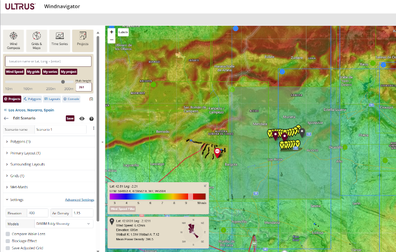
Projects Section
The new Projects section brings RRAP's advanced wind resource modeling directly into Windnavigator—empowering users to manage, analyze, and iterate on wind projects from a single, unified interface.
Project components are now automatically geo-located, significantly reducing the time spent searching and placing assets—so you can focus on optimizing performance, not managing data.
Project components are now automatically geo-located, significantly reducing the time spent searching and placing assets—so you can focus on optimizing performance, not managing data.
Layout Optimization
Design and refine turbine layouts for maximum efficiency.
Energy Yield Calculations
Run detailed energy production estimates, with or without map adjustments using met mast data.
Flexible Output Formats
Export results in a variety of formats to support downstream analysis and reporting.
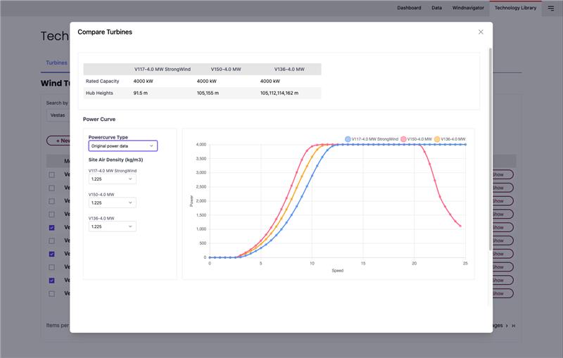
Enhanced Technology Library
Access a comprehensive and flexible library of wind technology data including:
Turbine Power Curves
Easily select and apply certified turbine models in your RRAP projects—now featuring official power curves from the industry's leading wind turbine providers.
Datasets for existing turbines and wind farms
The new Neighbor Turbines RADAR feature automatically detects nearby turbines and generates layout data—crucial for accurate wake modeling—while meaningly reducing manual effort. With integrated datasets from:
- OSM (OpenStreetMap) for turbine locations
- TheWindPower.net for global wind farm information
- Neighbor turbines RADAR feature for automatic detection of turbines data and layout generation
Global Horizontal Irradiance (GHI) Layer Integration
Gain depper insight into solar potential with the addition of the GHI layer for hybrid project planning and site evaluation.
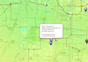
Integrated Surface Database (ISD)
The platform now includes access to the Integrated Surface Database (ISD), providing high-quality meteorological data from global weather stations. This supports more accurate validation and calibration of wind resource assessments.
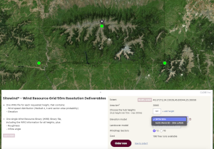
Custom Elevation Model Selection for Sitewind® WRG50
Users can now specify the elevation model usen when requesting a Sitewind® WRG50 (Wind Resource Grid at 50m resolution), offering greater control and accuracy in terrain-sensitive assessments.
Windnavigator
-
Instant Wind Speed InsightsAccess validated mean annual wind speed data instantly by clicking on any location or entering coordinates - no guesswork, just reliable data.
-
Comprehensive Environmental ContextVisualize your project site with layered wind maps and critical infrastructure data, including existing turbines, grid networks, land use, and bathymetry.
-
High-Resolution Wind Resource GridsAnalyze wind potential with precision using 200m and 50m resolution grids, available up to 300m hub height for accurate turbine siting.
-
Robust Historical & Long-Term Data SetsLeverage WRF and Reanalysis time series to understand wind behavior over time.
-
Smart Product SearchInstantly view all available data products for your selected location - GIS maps, WRGs, time series, whitepapers, and model validations.
RRAP
-
Define Buildable Areas with ConfidenceIdentify viable project zones using customizable polygons that account for environmental constraints, land ownership, and exclusion zones.
-
Latest Wind Turbine ModelsBrowse an up-to-date catalog of turbines from leading manufacturers, with automatic detection of neighboring turbines.
-
High-Precision Wind Resource GridsUtilize UL WRG200 grids, pre-adjusted with data from over 5000 verified met masts, for accurate horizontal extrapolation and optimized wind farm design.
-
Optimization Advance SettingsFine-tune your project with customizable parameters - iterations, installed capacity, boundary conditions, wake models, and more.
-
Energy Yield EvaluationIncluding energy capture mode, custom losses, blockage effect estimation and impact of wakes from neighbor wind farms. Results exportable in .csv, .txt, .json, .pdf and .blb formats.
Ready to optimize your data collection and analysis capabilities for wind energy prospecting?
Schedule a demo with a UL Solutions software expert today.